Industry
Polish “Passive Location System” - Response to Active Jamming and Stealth Technologies.

Passive Location System (SPL - System Pasywnej Lokacji) is a globally unique airspace observation tool. The system in question provides continuous airspace monitoring and reconnaissance data. This happens independently from active radar without any emissions, which renders the Polish solution undetectable for the enemy ESM systems. SPL has been designed and is being developed by a consortium formed by the following entities: PIT-RADWAR S.A. (leader), AM Technologies and the Warsaw University of Technology.
The SPL system is also known as PET/PCL, as it fuses two complementary passive subsystems: PCL (Passive Coherent Location) and PET (Passive Emitter Tracking). SPL has been designed to deliver radar data for the airspace monitoring systems and to carry out initial target detection and designation for the medium- and short range anti-aircraft missile systems.
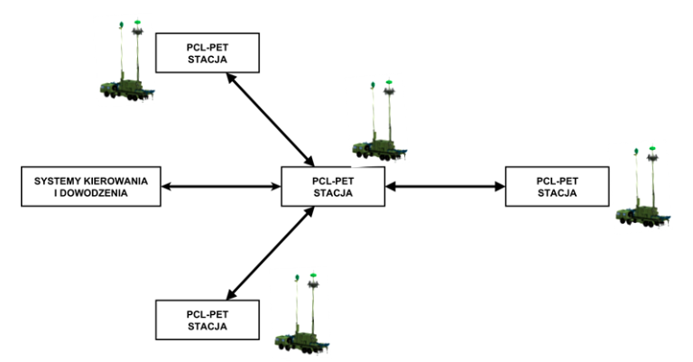
The SPL system that may include from one to 4 passive location radars (RPL - Radar Pasywnej Lokacji) deployed on the ground, makes it possible to achieve multistatic operation, with a coverage of a wide range of frequency spectrum. Thus it may be viewed as a solution that is scattered over a large area and covers a wide frequency range, thanks to its analytical capability that makes it possible to interpret data with a high space-frequency diversity.
What is the Structure of the SPL Solution?
Each of the RPL stations features seven independent subsystems (3 in PCL and 4 in PET portions of the solution). The PCL subsystem makes use of the signals emitted by occasional emitters, such as the FM radio, DVB-T or cellular GSM sources. These signals, scattered on the airborne objects and received by the individual stations, make it possible to detect and locate the individual objects mentioned above. The PET subsystem, meanwhile, detects the signals generated by the onboard emitters of the airborne objects, including radars, datalinks, IFF systems and navigation systems. Connecting the PCL/PET systems together and using a fusion module results in increased detection probability and higher accuracy in locating the target, and thus allows the user to achieve a more stable target tracking and enhanced classification functionality with regards to airborne threats. This is achieved via a detailed signal analysis.
The system designed by the consortium acts as a multistatic solution composed out of 4 RPL radars that are identical, hardware- and software-wise. The fusion module is the key to the high effectiveness of the system. It creates a fusion of bistatic tracks of both subsystems. To define the position of each of the objects (3D coordinates) at least 3 bistatic PCL system tracks are required, while two triangulation angular tracks make it possible to determine the 2D coordinates of the target.
PET subsystem requires at least three time differences from different RPL radar pairs (bistatic PET tracks) to define the target’s spatial position (3D coordinates) with the use of the TDoA (Time-Difference-of-Arrival) technique. As a result of the above, the latter requirement determines the number of required radars. However, considering the fact that usually significantly more than 3 PET and PCL subsystems receiver channels are involved in tracks fusion, the 3D location conditions are usually met even when a smaller quantity of RPL units is put into use (1 to 4).
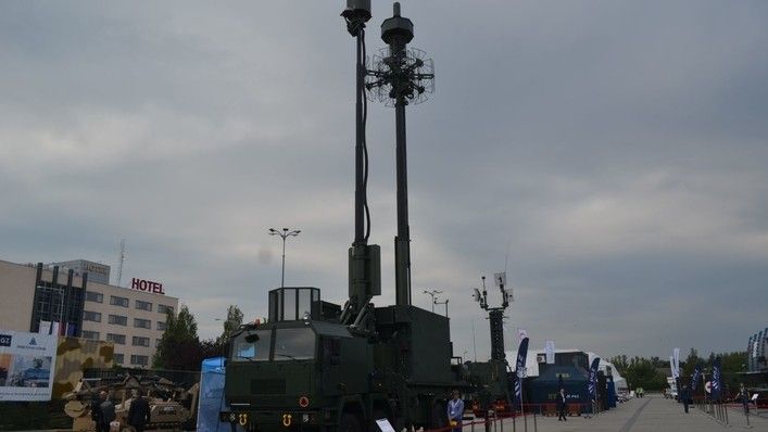
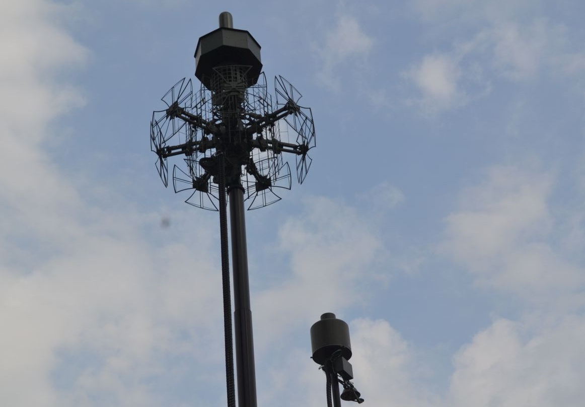
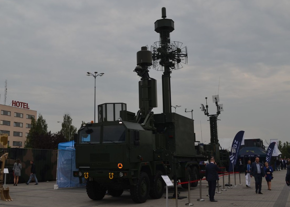
Each of the 4 RPL radars is installed on identical 4-axle wheeled platform also featuring operator station in a container and two antenna systems set up on two mechanically deployed masts. In case of PCL an antenna array system (for reception) has been applied, using bipolar antenna arrays which, contrary to single-polarity antenna arrays, makes it possible to utilize signals provided from a wider spectrum of occasional transmitters.
All of the RPL radars are identical, as sources of information. However, one of those stations has a master-role assigned. That station is used to fuse the data from the remaining radars, to create an integrated air picture on the basis of the SIGINT gathered. The “master” radar connects to the C2 systems to which it is subordinated, transferring the SIGINT data or taking over the commands to indicate the region of interest or range of frequencies to be scanned.
Thanks to the fact that SPL makes use of the space-frequency diversity, it is possible to detect a variety of airborne threats, including the stealth aircraft.
Applications of the System Beyond the Military Domain
SPL may be used for the purposes assigned by the MoD, but also other Ministries, in the areas of operation of bodies such as PANSA, within the scope of air traffic control; Border Guard and Customs Service, within the scope of detecting illegal airspace intrusions.
Apart from the aforesaid operational attributes, so relevant for national security, SPL, both when used by the MoD as well as by the civil authorities, is attractive for environmental reasons as it does not act as a source of high-power electromagnetic radiation. Furthermore, considering the above, there is no need to allocate a separate frequency band range for the SPL to operate. Taking the innovative and unique character of the system into account, internationally speaking, along with the fact that it has been developed in Poland for the first time, as well as the interest it enjoys outside Poland, there is a potential chance to direct the sales income related to this system into the Treasury.

